Days Four to Seven (final post)
24/05/25 09:14
I am back in Oakland and now have some time to finish my account of my trip since leaving Ely…
After day three, I headed to Hickison Petroglyph Recreation Area for my first overnight camping in the electric Mustang Mach E. I had read about the area, and since it was on the route I was backtracking along to Eureka and Austin, I thought that it would be a good opportunity to experience sleeping in the car.
When I arrived at the site, I chose a fairly level spot to park. The camping is free, so you can pick the site of your liking as long as no one else is occupying it. I proceeded to set up the foam pads and air mattress.
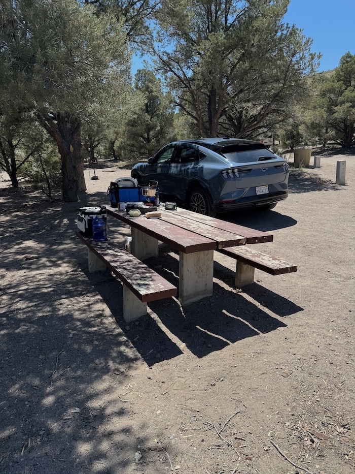
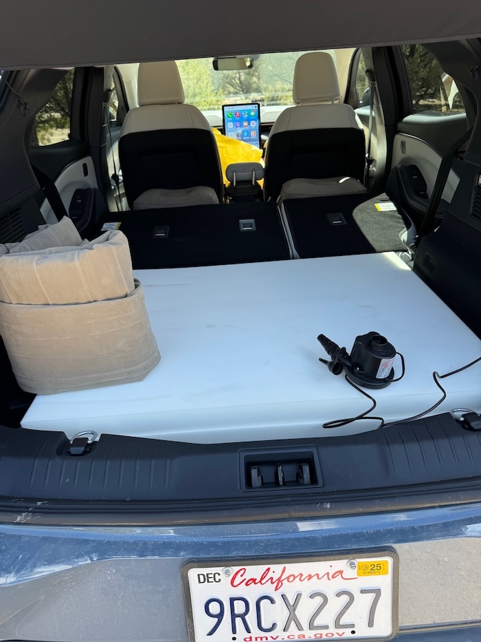
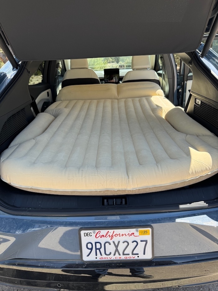
I had bought a delicious sandwich made to order by the deli in a big supermarket just to the west of Eureka—the only decent market that I encountered along The Loneliest Road—and I enjoyed my lunch at the campsite picnic table before exploring the park on its trails.
I started on my walk and soon discovered examples of the petroglyphs for which the recreation area is named. Scientists believe that the rock carvings were created about 10,000 years ago by the Western Shoshone who inhabited the region when it was filled with lakes leftover from the disappearance of the ocean.
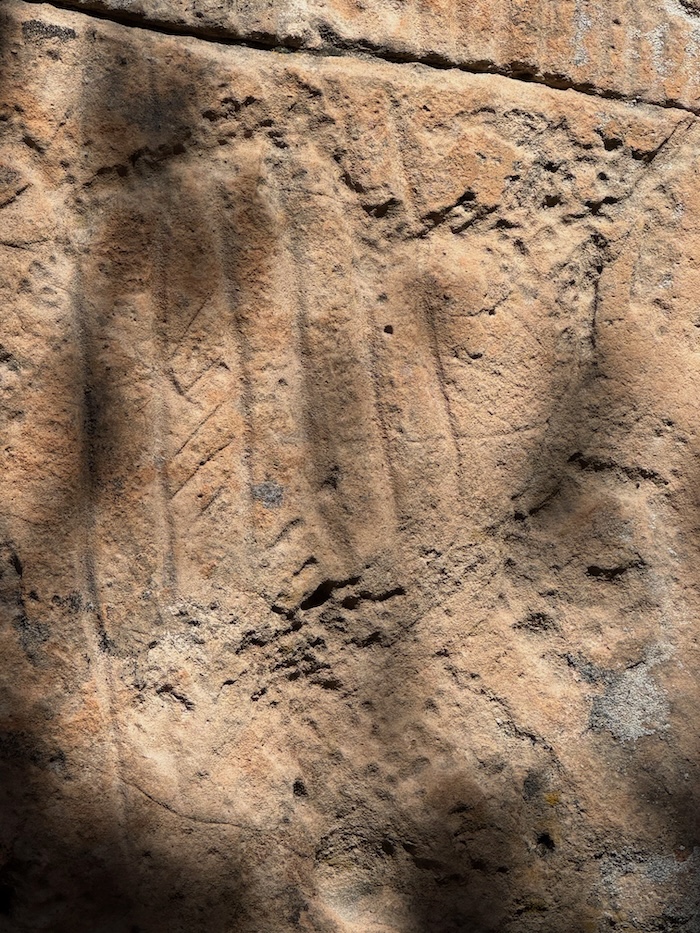
With many of the carvings, I found it difficult to decipher what they were depicting. There were lots of pock marks and sweeping lines. But nothing familiar was jumping out at me.
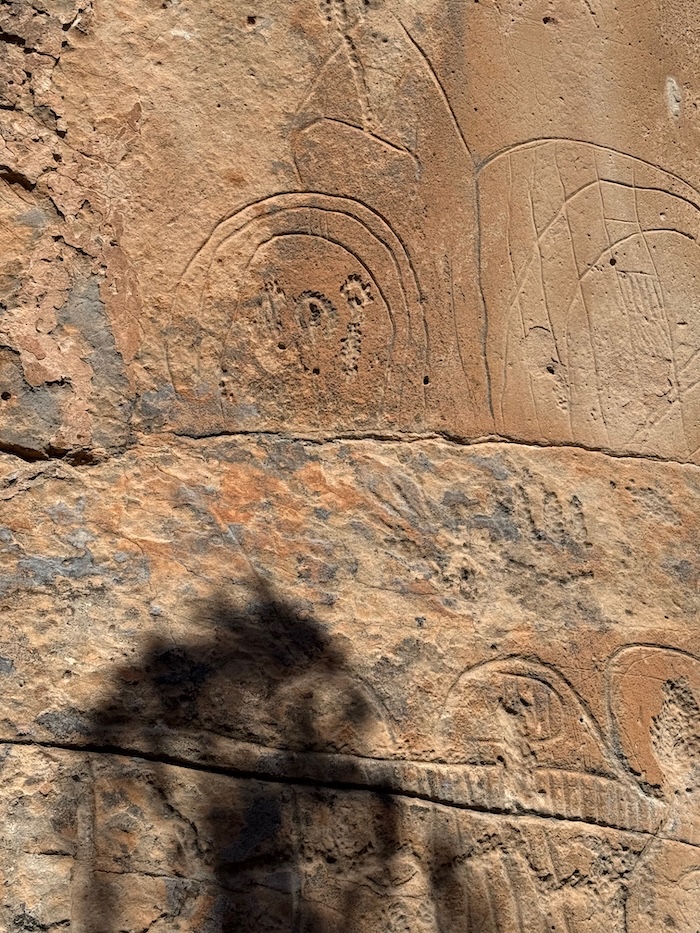
In some cases, however, the lines looked like human fingers and may well have been.
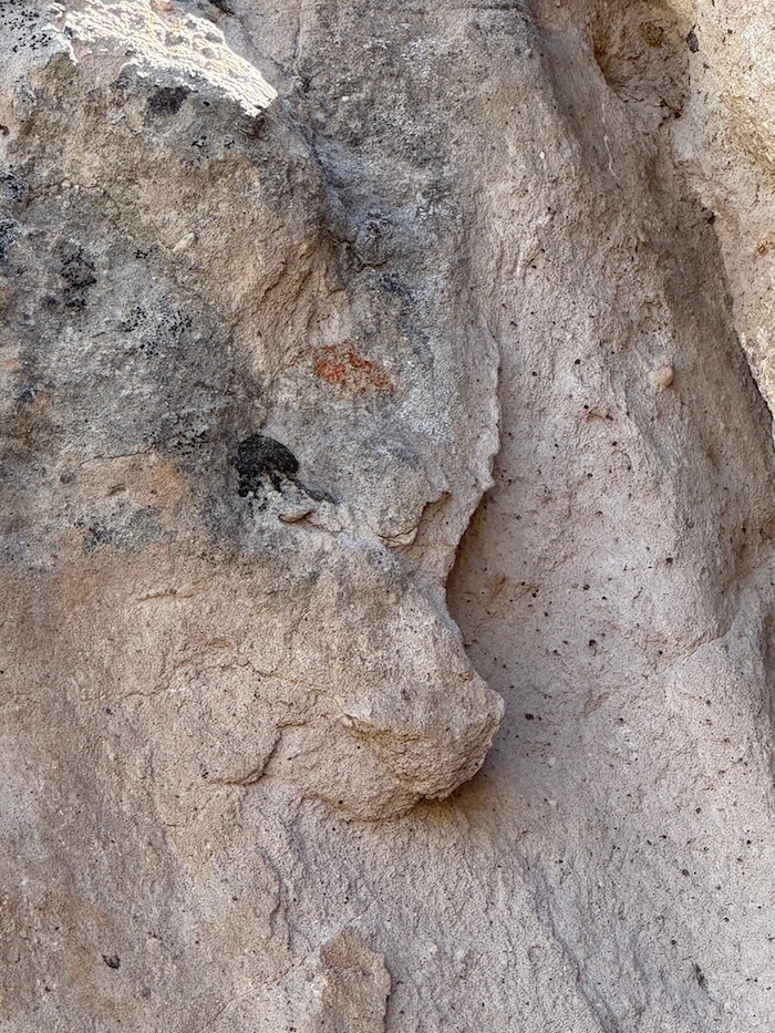
I believe that this one was of a bear. If you look closely, you will see the ears, the eyes, then the protruding snout with the nose at the tip. Just above the bear may be a carving of a human face, with the head turned back, hair above the forehead, one eye visible, nose, lips, and chin. Maybe that is a look of pride, the hunter with prey below.
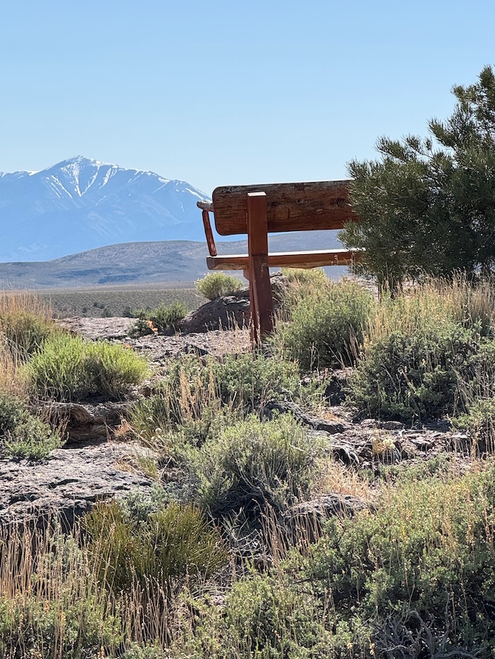
After the extensive look at the petroglyphs, I wandered up a trail with a fabulous bench at the top where I could sit and take in the view. I remained seated there for about forty-five minutes, thinking about the people who were in this area carving the rock, leaving their mark for future generations. Was that flat area below where an ancient receding lake used to be?
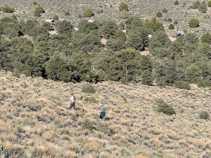
You can see a couple hiking up the same trail that I was coming down, with the campground below them:
My best laid plans to enjoy my night of restful sleep in the back of the Mustang Mach E were all for naught. I woke up at 2:30 a.m. absolutely freezing. I had foolishly left the windows slightly open to cope in case my occasional claustrophobia were to kick in.
I desperately needed to warm up, and decided shortly thereafter to "get the hell out of Dodge". I threw everything in the car and quietly left the campground. (Remember, it is an electric car, so I am reasonably certain that I did not disturb the other campers!).
I made my way back to Austin by 4 a.m. and began charging the car at a place (Champ's Chevron) where I had charged it once before.
Austin in the middle of the day is a pretty sleepy place. At 4:00 a.m., it feels like one has entered the Twilight Zone. It is completely desolate. No lights were on, and not a sound could be heard. It seemed almost as if it were fast becoming a true ghost town. That is most likely the fate that awaits Austin, because, except for Champ's Chevron Gas Station and Store, most things appear to be permanently closed already.
While waiting alone for the nearly depleted Mustang battery to charge, I prepared coffee on my tiny backpacking stove in the parking lot. At 5:25 a.m., when I was preparing a second cup, the woman who runs the service station store arrived to open it. She came rushing over to me concerned about the small flame she had seen from the stove I was using to make my drip coffee. I was set up about 100 feet away from four enormous propane tanks. After I reassured her that I was being extremely cautious about the flame, and that I was far enough away from those propane tanks, she returned to her duties.
I had planned to spend that night in Berlin-Ichthyosaur State Park. However, after my experience the night before, I decided to ditch the idea of camping anymore. After the car was fully charged, I was off to Tonopah by 5:30 a.m..
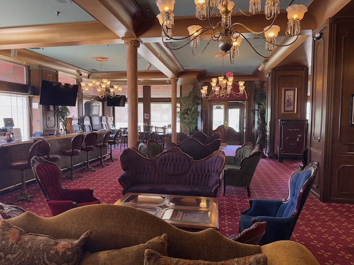
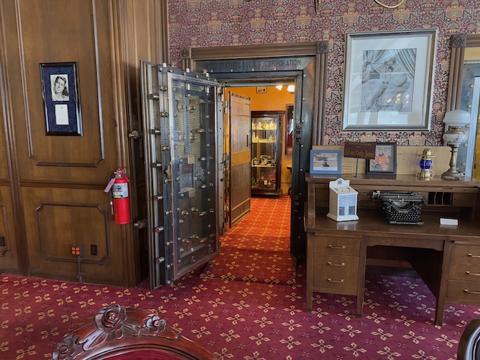
I stayed that night at Tonapah's historic Mizpah Hotel, on the same floor where the "Lady in Red" was allegedly strangled by her former lover in the late 1800s. You can read about it here. Not to worry, I have no personal ghost stories to tell you.
Originally, I had planned to spend the following night at Benton Hot Springs just over the border in California, but, as I wrote above, I wasn't up for the camping that was a part of that plan. Instead, I decided to spend the night in Bishop on Highway 395, to pass through Benton again the next day and take a dip in the hot tub that I had reserved, to spend the following night in Bridgeport, and for the final night of my trip, to stay at the National Hotel in the gold rush town of Jackson.
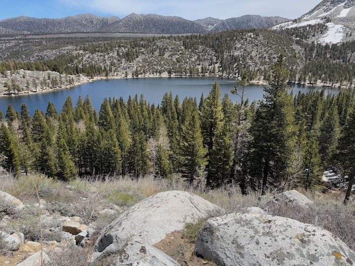
That was all not to be. After exploring a few of the beautiful lakes that are part of the Eastern High Sierra, I went back to Benton and only sat in the hot tub for about 45 minutes. It was way too hot, and in spite of the fact that they advertised that there was a cold faucet at each hot tub, that was not the case at mine. So I started on my way on highway 120 to Bridgeport.
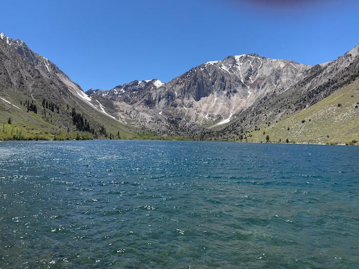
Convict Lake
Above Sabrina Lake
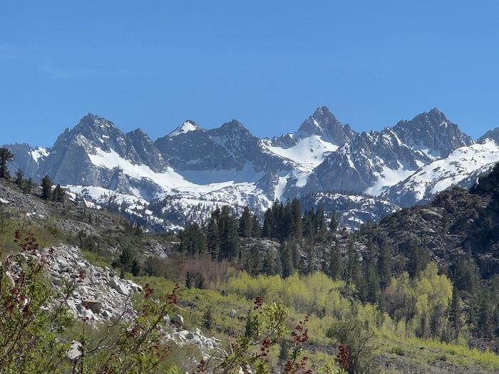
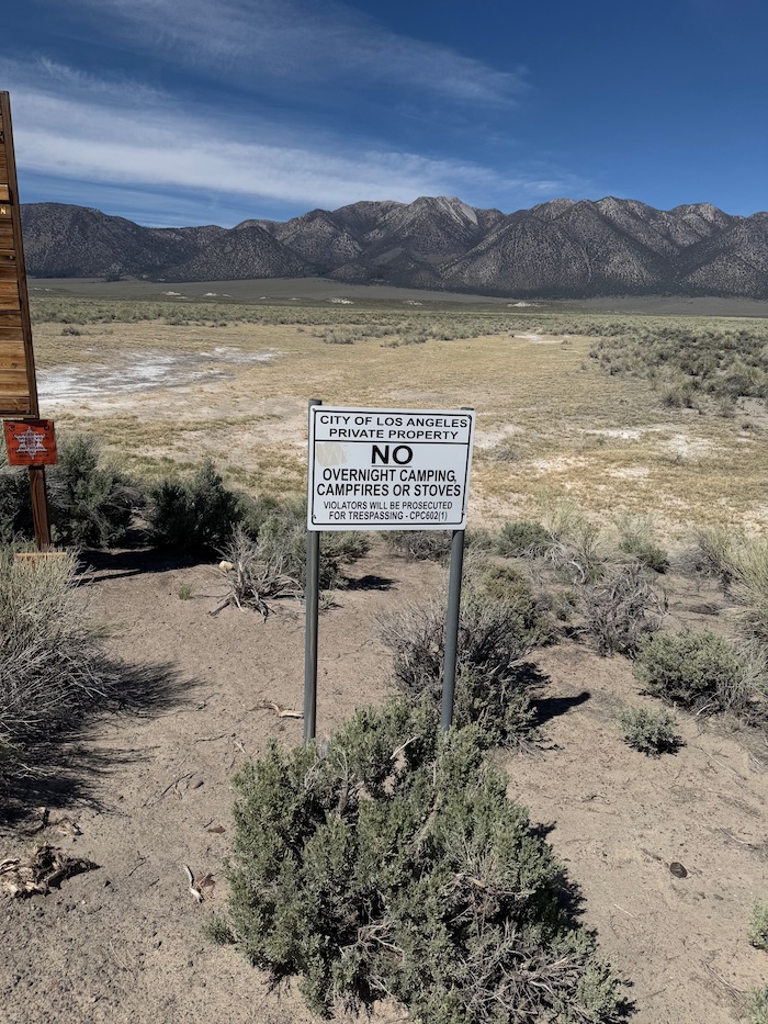
Sabrina Lake. Note how empty it is. Like most of the high mountain lakes that feed the Owens River down in the valley below, the water along the eastern side of the Sierra Nevada is completely owned and controlled by the City of Los Angeles. And the power generated by the stream outflow is controlled by Southern California Edison.
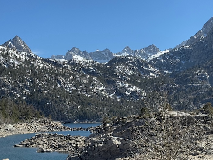
Rocky Creek Lake
In the Owens River Valley between Mammoth Springs and Benton. The sign says it all, "L.A. is the big boss":
While driving along the spectacular stretch of road that goes between Benton and Lee Vining near Mono Lake, I could periodically see a plume of smoke. I just assumed that it was some sort of controlled burn.
When I arrived back on highway 395 at Lee Vining, I discovered that there was a big wildfire and 395 was closed there. A big dump truck, some Cal Trans workers, and a highway patrolman were blocking the highway, with huge smoke and flames billowing seemingly just a few hundred feet away from them.
They told me that the road would be closed for an indefinite period of time. Meanwhile, lots of air tankers were dropping fire retardant over the still growing fire. The highway patrolman recommended an alternative route through Hawthorne, Nevada that would end up on the road just a mile or two north of the fire. That seemed like kind of a riverboat gamble to me: drive on a detour for almost three hours through another state only to discover that the raging fire had blocked your new route.
Because I wasn't sure that I would be able to recharge the car on the long distance route that was suggested going back through Hawthorne, I decided that reason should prevail. I would need to drive all of the way to Bakersfield, spending the night along the way at Lone Pine. No mountain passes over the Sierra were open, except those beyond the fire zone on 395.
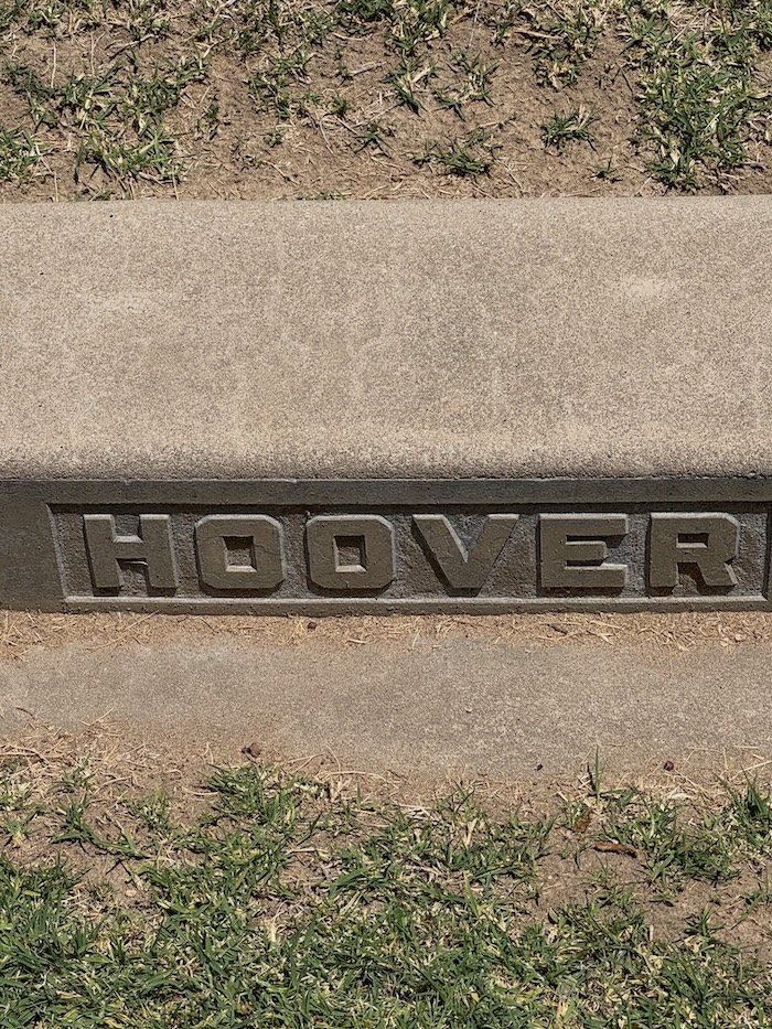
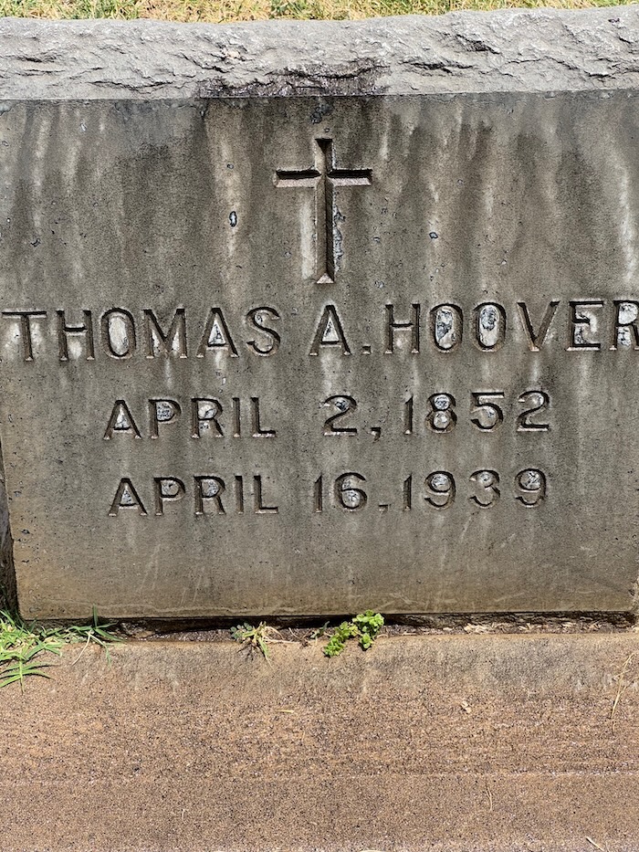
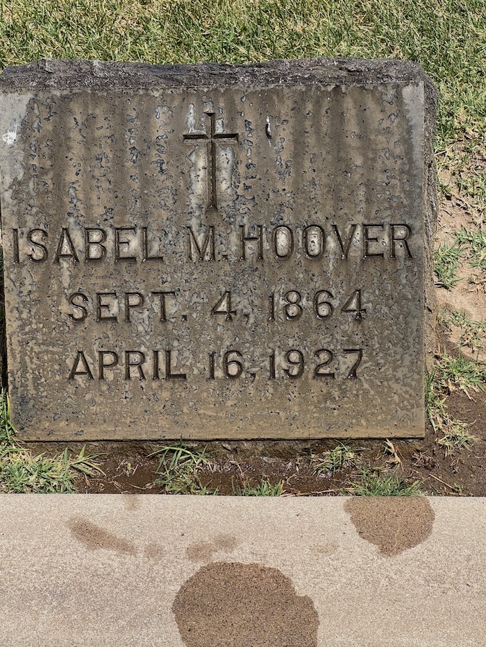
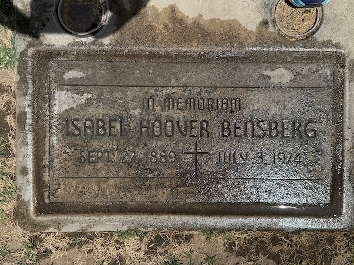
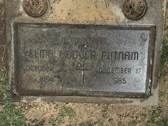
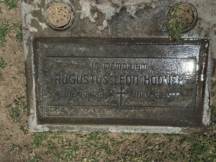
The following day, I headed up toward Oakland around the map's "route horn" at Bakersfield. I stopped for a brief visit at Fresno's Calvary Catholic Cemetery. For those of you reading this who are not family members, my great grand-parents Thomas Adam Hoover and Isabel Mary Hoover (my mother Rhoda's grandparents) are buried there. Although I had been to the cemetery before, it was sort of on my route and I decided to go by there and see it again.
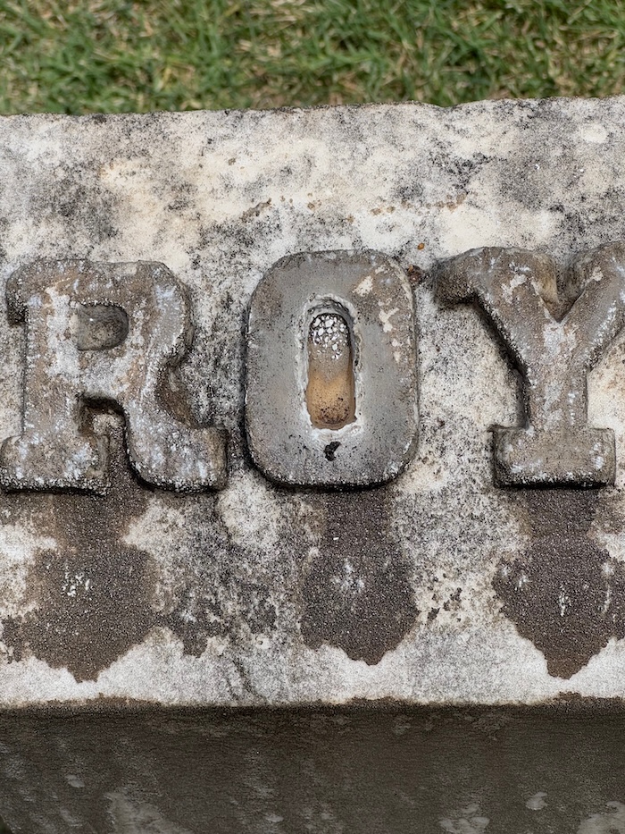
The Hoover's first son Roy tragically died at the age of six of a typhoid contagion carried in the family well. He is buried there on the family plot with his parents. On the occasion of her own mother Elma's death, my mother's first cousin Isabel thoughtfully arranged for plaques to be placed on the site honoring the Hoover's three other children, my grandmother Isabel Hoover Bensberg, my great aunt Elma Hoover Putnam, and my great Uncle Augustus "Gus" Hoover. Note that the dark color of the markers was from me pouring water over them so that they would be more legible for the photos. As with the petroglyphs carved by the Western Shoshone thousands of years ago, even gravestones age very quickly.
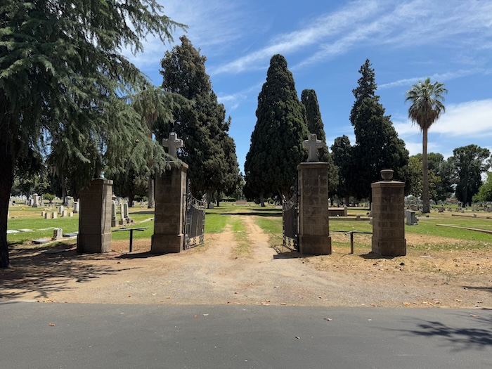
I finally arrived home late Friday.
The loneliest road is now off of my bucket list, but it was a great and interesting adventure for me. Thanks for reading!
Kent
After day three, I headed to Hickison Petroglyph Recreation Area for my first overnight camping in the electric Mustang Mach E. I had read about the area, and since it was on the route I was backtracking along to Eureka and Austin, I thought that it would be a good opportunity to experience sleeping in the car.
When I arrived at the site, I chose a fairly level spot to park. The camping is free, so you can pick the site of your liking as long as no one else is occupying it. I proceeded to set up the foam pads and air mattress.
I had bought a delicious sandwich made to order by the deli in a big supermarket just to the west of Eureka—the only decent market that I encountered along The Loneliest Road—and I enjoyed my lunch at the campsite picnic table before exploring the park on its trails.
I started on my walk and soon discovered examples of the petroglyphs for which the recreation area is named. Scientists believe that the rock carvings were created about 10,000 years ago by the Western Shoshone who inhabited the region when it was filled with lakes leftover from the disappearance of the ocean.
With many of the carvings, I found it difficult to decipher what they were depicting. There were lots of pock marks and sweeping lines. But nothing familiar was jumping out at me.
In some cases, however, the lines looked like human fingers and may well have been.
I believe that this one was of a bear. If you look closely, you will see the ears, the eyes, then the protruding snout with the nose at the tip. Just above the bear may be a carving of a human face, with the head turned back, hair above the forehead, one eye visible, nose, lips, and chin. Maybe that is a look of pride, the hunter with prey below.
After the extensive look at the petroglyphs, I wandered up a trail with a fabulous bench at the top where I could sit and take in the view. I remained seated there for about forty-five minutes, thinking about the people who were in this area carving the rock, leaving their mark for future generations. Was that flat area below where an ancient receding lake used to be?
You can see a couple hiking up the same trail that I was coming down, with the campground below them:
My best laid plans to enjoy my night of restful sleep in the back of the Mustang Mach E were all for naught. I woke up at 2:30 a.m. absolutely freezing. I had foolishly left the windows slightly open to cope in case my occasional claustrophobia were to kick in.
I desperately needed to warm up, and decided shortly thereafter to "get the hell out of Dodge". I threw everything in the car and quietly left the campground. (Remember, it is an electric car, so I am reasonably certain that I did not disturb the other campers!).
I made my way back to Austin by 4 a.m. and began charging the car at a place (Champ's Chevron) where I had charged it once before.
Austin in the middle of the day is a pretty sleepy place. At 4:00 a.m., it feels like one has entered the Twilight Zone. It is completely desolate. No lights were on, and not a sound could be heard. It seemed almost as if it were fast becoming a true ghost town. That is most likely the fate that awaits Austin, because, except for Champ's Chevron Gas Station and Store, most things appear to be permanently closed already.
While waiting alone for the nearly depleted Mustang battery to charge, I prepared coffee on my tiny backpacking stove in the parking lot. At 5:25 a.m., when I was preparing a second cup, the woman who runs the service station store arrived to open it. She came rushing over to me concerned about the small flame she had seen from the stove I was using to make my drip coffee. I was set up about 100 feet away from four enormous propane tanks. After I reassured her that I was being extremely cautious about the flame, and that I was far enough away from those propane tanks, she returned to her duties.
I had planned to spend that night in Berlin-Ichthyosaur State Park. However, after my experience the night before, I decided to ditch the idea of camping anymore. After the car was fully charged, I was off to Tonopah by 5:30 a.m..
I stayed that night at Tonapah's historic Mizpah Hotel, on the same floor where the "Lady in Red" was allegedly strangled by her former lover in the late 1800s. You can read about it here. Not to worry, I have no personal ghost stories to tell you.
Originally, I had planned to spend the following night at Benton Hot Springs just over the border in California, but, as I wrote above, I wasn't up for the camping that was a part of that plan. Instead, I decided to spend the night in Bishop on Highway 395, to pass through Benton again the next day and take a dip in the hot tub that I had reserved, to spend the following night in Bridgeport, and for the final night of my trip, to stay at the National Hotel in the gold rush town of Jackson.
That was all not to be. After exploring a few of the beautiful lakes that are part of the Eastern High Sierra, I went back to Benton and only sat in the hot tub for about 45 minutes. It was way too hot, and in spite of the fact that they advertised that there was a cold faucet at each hot tub, that was not the case at mine. So I started on my way on highway 120 to Bridgeport.
Convict Lake
Above Sabrina Lake
Sabrina Lake. Note how empty it is. Like most of the high mountain lakes that feed the Owens River down in the valley below, the water along the eastern side of the Sierra Nevada is completely owned and controlled by the City of Los Angeles. And the power generated by the stream outflow is controlled by Southern California Edison.
Rocky Creek Lake
In the Owens River Valley between Mammoth Springs and Benton. The sign says it all, "L.A. is the big boss":
While driving along the spectacular stretch of road that goes between Benton and Lee Vining near Mono Lake, I could periodically see a plume of smoke. I just assumed that it was some sort of controlled burn.
When I arrived back on highway 395 at Lee Vining, I discovered that there was a big wildfire and 395 was closed there. A big dump truck, some Cal Trans workers, and a highway patrolman were blocking the highway, with huge smoke and flames billowing seemingly just a few hundred feet away from them.
They told me that the road would be closed for an indefinite period of time. Meanwhile, lots of air tankers were dropping fire retardant over the still growing fire. The highway patrolman recommended an alternative route through Hawthorne, Nevada that would end up on the road just a mile or two north of the fire. That seemed like kind of a riverboat gamble to me: drive on a detour for almost three hours through another state only to discover that the raging fire had blocked your new route.
Because I wasn't sure that I would be able to recharge the car on the long distance route that was suggested going back through Hawthorne, I decided that reason should prevail. I would need to drive all of the way to Bakersfield, spending the night along the way at Lone Pine. No mountain passes over the Sierra were open, except those beyond the fire zone on 395.
The following day, I headed up toward Oakland around the map's "route horn" at Bakersfield. I stopped for a brief visit at Fresno's Calvary Catholic Cemetery. For those of you reading this who are not family members, my great grand-parents Thomas Adam Hoover and Isabel Mary Hoover (my mother Rhoda's grandparents) are buried there. Although I had been to the cemetery before, it was sort of on my route and I decided to go by there and see it again.
The Hoover's first son Roy tragically died at the age of six of a typhoid contagion carried in the family well. He is buried there on the family plot with his parents. On the occasion of her own mother Elma's death, my mother's first cousin Isabel thoughtfully arranged for plaques to be placed on the site honoring the Hoover's three other children, my grandmother Isabel Hoover Bensberg, my great aunt Elma Hoover Putnam, and my great Uncle Augustus "Gus" Hoover. Note that the dark color of the markers was from me pouring water over them so that they would be more legible for the photos. As with the petroglyphs carved by the Western Shoshone thousands of years ago, even gravestones age very quickly.
I finally arrived home late Friday.
The loneliest road is now off of my bucket list, but it was a great and interesting adventure for me. Thanks for reading!
Kent
