Day One
17/05/25 20:32
I am creating this blog as an easier way of communicating to family and friends about what I am “up to” between May 16th and 24th. Some of you may be aware that I was originally planning on driving a few of my high school classmates across Nevada on the "Loneliest Road In America", Highway 50. We would drive in Cyndi’s and my new electric Ford Mustang Mach E. We were going to a mini-reunion near St. George, Utah and Zion National Park that was planned for mid-April. The reunion and the road trip got cancelled because of dwindling enthusiasm and scheduling conflicts. That was all okay with me, but I still wanted to do the challenge: fight range anxiety by driving across a pretty desolate landscape. And I couldn’t get any takers to go with me.
So with Cyndi’s encouragement, I am off and running on a solo journey into the territory served by the aptly-named road. I will intersperse my blog with locations where I am staying. For three nights, I will be camping while sleeping in a “tricked out” Mustang. Here is the Mach E forum posting where I found the necessary info.
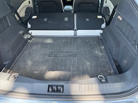
I found the foam here, right in my back yard along San Pablo Avenue. I special-ordered from the foam store two 2" pieces. Sandwiched together, they now temporarily cover the back area in the Mustang behind the folded back seats. They will serve to bridge the different level of the folded seats. Over that will go a special air mattress that I bought expressly for the car.
Below are some photos that I took today during my trip from Fallon to Eureka…
I have already had two salads of this "gourmet Nevada quality". The first was in Fernley while I was waiting for the Mustang to charge. The second was tonight in Eureka. Iceberg lettuce and bottled dressing are apparently a thing in this desolate territory!
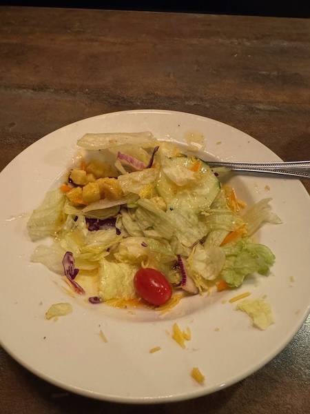
So the "haute cuisine" is not something that might lure visitors to the route, at least not the kind who are spoiled from Oakland and its great restaurants.
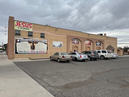
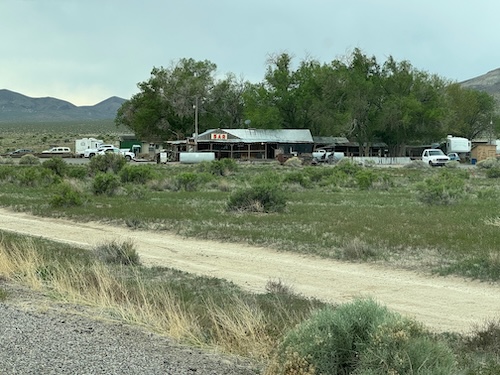
And I saw some evidence that would make me not inclined to move to downtown Fallon. I don't know whether or not this place caters to the service men and women who work on the U.S. Navy's airstation nearby.
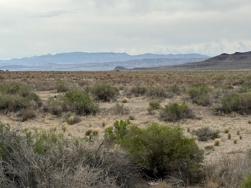
Along the way, though, the scenery and vibe can be quite spectacular.
To help understand the next photos and accompanying text, here is a blurb from AI:
Lake Lahontan was a large prehistoric lake that existed during the Pleistocene era, covering parts of modern northwestern Nevada, northeastern California, and southern Oregon. Today, remnants of this ancient lake include Pyramid Lake and Walker Lake, while the modern Lake Lahontan is a reservoir created for irrigation purposes.
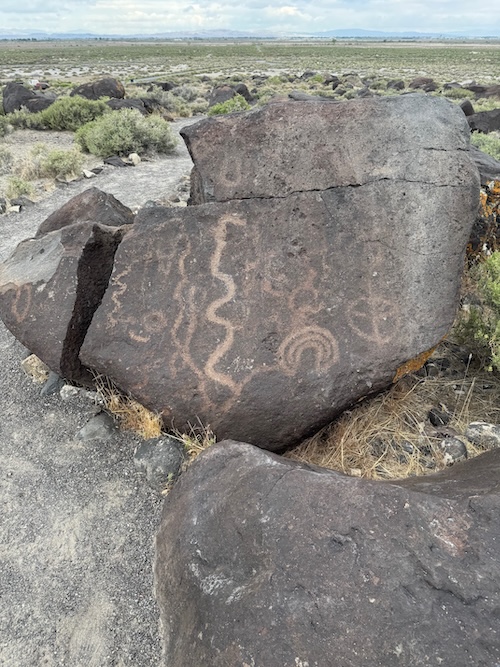
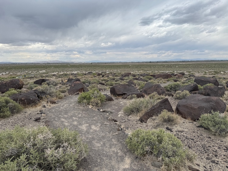
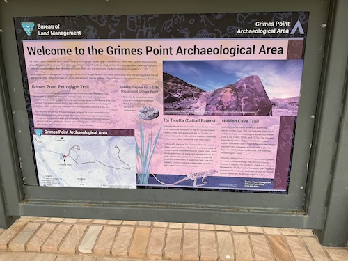
Grimes Point petroglyph site is one cool place between Fallon and Austin. Somewhere between 5,000 and 10,000 years ago, native peoples carved petroglyphs in a huge field of basalt boulders. Those boulders, (which at one time were under the ocean) were on the shores of an enormous prehistoric Lake Lahontan that filled the entire valley shown in this scene. For perspective, I zoomed in as much as I could, because the Fallon Naval Air Station (one of the hangers is shown) was a dot on the horizon from where I was standing.
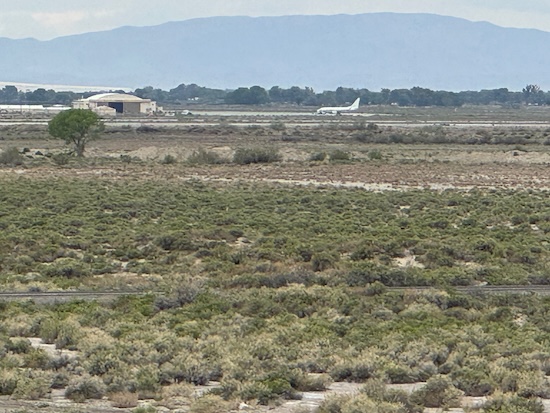
Looking the other way among the field of basalt boulders, you can see flat lines on the mountainside which are remnants of the declining shoreline of the former lake.
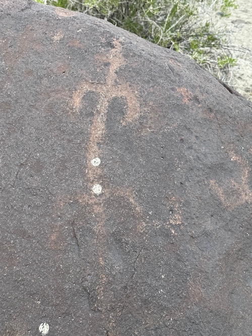
Here are several shots of the petroglyphs on the boulders. One speculation is that hunters were hiding for long stretches behind these boulders, waiting for antelope to appear on the shores of the ancient lake. Perhaps the images were created by those bored hunters. Others have speculated that the acts of creating the petroglyphs were inspired by shamans who were present with the artists. Perhaps they all were participating in rituals together.
Highway 50 is not always a straight flat road on which you can easily and safely drive 90 miles an hour. Yes, one travels huge distances like that. Except for when I was in a hurry to get to Eureka to attend a fiddle contest, I usually drove the speed limit which is 70 miles per hour.
Sometimes, the road takes you over 6,500 foot mountain passes. There are frequently scenes like the following:
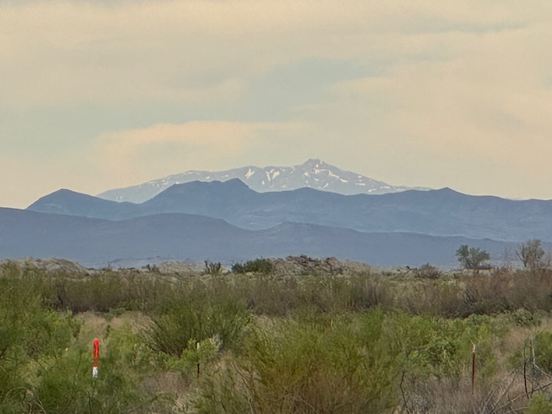
On one of the mountain passes before I got to Eureka, it was pouring rain. Then it started to sleet heavily. I was pretty concerned that it might snow, because I am not carrying chains. But I made it safely to my destination.
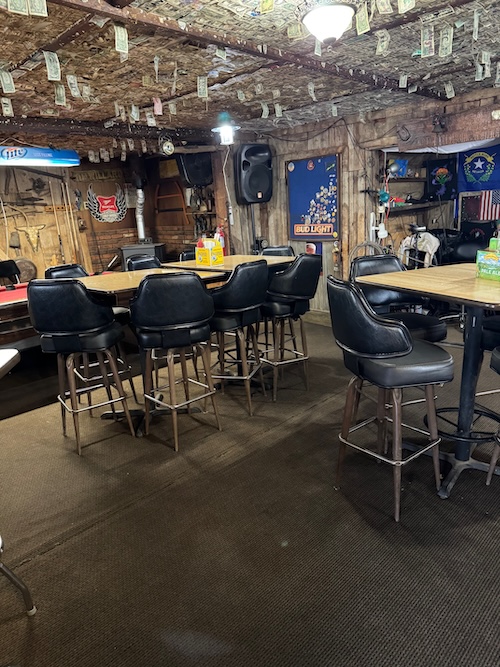
Out in the middle of nowhere is a place where Cyndi and I stopped for dinner in the fall of 2014, a former Pony Express stop—yes, Highway 50 follows the old Pony Express Trail—Middlegate Station.
Note the dollar bills pinned to the ceiling everywhere:
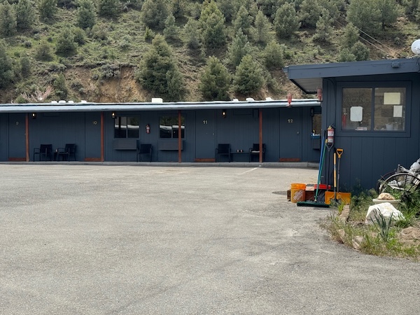
Another place that Cyndi and I stopped in 2014 was Austin. In fact, we stayed overnight in this "Cozy Mountain Motel":
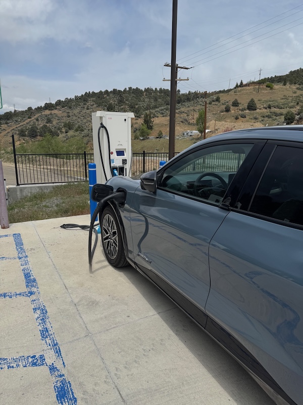
I was able to fully charge the Mustang at Champ's Chevron in Austin. If I hadn't been able to do so, I would have had to abort the trip and return to Fernley. The EV charging stations are really few and far between. It was a calculated risk, but it paid off and the rest of the journey is now assured.
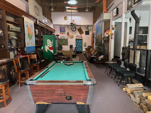
Austin is a dead town on Saturday. This photo was taken through a closed store window.
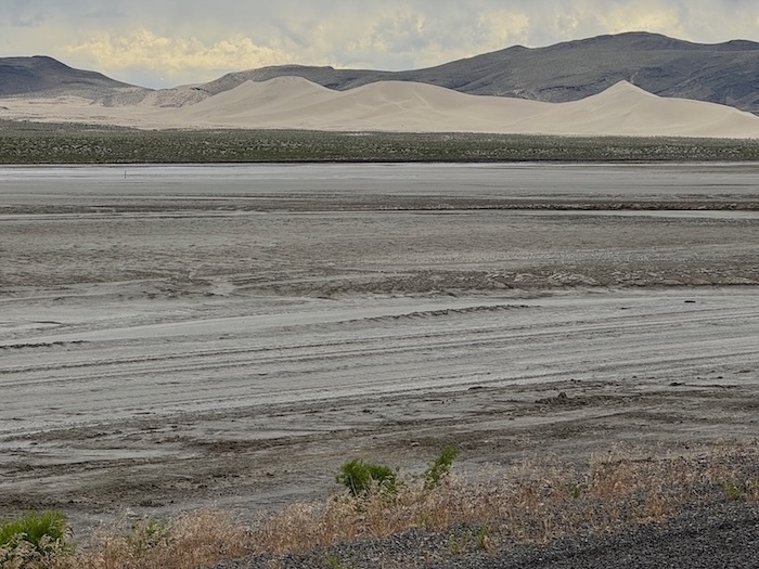
There is enough variety in the scenery along to route to make the drive quite interesting. Here is an enormous sand dune with a giant salt field in front of it, further proof of the ocean environment from eons ago:
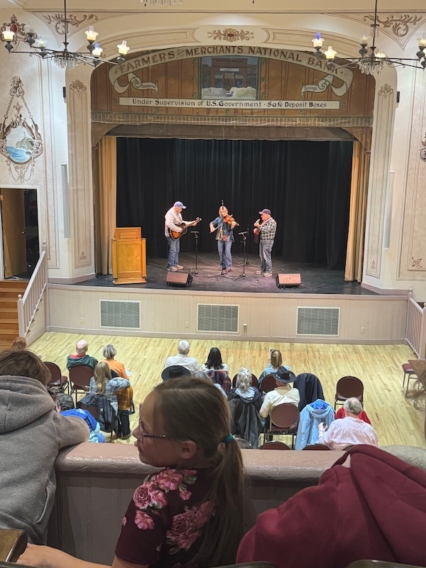
In the afternoon, I attended a fiddle contest held in the wonderful Opera House in Eureka. The Opera House is a vestige of better times when silver and gold mines were flourishing. There were four different age categories for the contest, and the fiddlers were from all over Oregon, California, and Nevada. In the senior category, a fiddler from San Rafael won!
As I finish today's entries, I am headed off to Ely.
So with Cyndi’s encouragement, I am off and running on a solo journey into the territory served by the aptly-named road. I will intersperse my blog with locations where I am staying. For three nights, I will be camping while sleeping in a “tricked out” Mustang. Here is the Mach E forum posting where I found the necessary info.
I found the foam here, right in my back yard along San Pablo Avenue. I special-ordered from the foam store two 2" pieces. Sandwiched together, they now temporarily cover the back area in the Mustang behind the folded back seats. They will serve to bridge the different level of the folded seats. Over that will go a special air mattress that I bought expressly for the car.
Below are some photos that I took today during my trip from Fallon to Eureka…
I have already had two salads of this "gourmet Nevada quality". The first was in Fernley while I was waiting for the Mustang to charge. The second was tonight in Eureka. Iceberg lettuce and bottled dressing are apparently a thing in this desolate territory!
So the "haute cuisine" is not something that might lure visitors to the route, at least not the kind who are spoiled from Oakland and its great restaurants.
And I saw some evidence that would make me not inclined to move to downtown Fallon. I don't know whether or not this place caters to the service men and women who work on the U.S. Navy's airstation nearby.
Along the way, though, the scenery and vibe can be quite spectacular.
To help understand the next photos and accompanying text, here is a blurb from AI:
Lake Lahontan was a large prehistoric lake that existed during the Pleistocene era, covering parts of modern northwestern Nevada, northeastern California, and southern Oregon. Today, remnants of this ancient lake include Pyramid Lake and Walker Lake, while the modern Lake Lahontan is a reservoir created for irrigation purposes.
Grimes Point petroglyph site is one cool place between Fallon and Austin. Somewhere between 5,000 and 10,000 years ago, native peoples carved petroglyphs in a huge field of basalt boulders. Those boulders, (which at one time were under the ocean) were on the shores of an enormous prehistoric Lake Lahontan that filled the entire valley shown in this scene. For perspective, I zoomed in as much as I could, because the Fallon Naval Air Station (one of the hangers is shown) was a dot on the horizon from where I was standing.
Looking the other way among the field of basalt boulders, you can see flat lines on the mountainside which are remnants of the declining shoreline of the former lake.
Here are several shots of the petroglyphs on the boulders. One speculation is that hunters were hiding for long stretches behind these boulders, waiting for antelope to appear on the shores of the ancient lake. Perhaps the images were created by those bored hunters. Others have speculated that the acts of creating the petroglyphs were inspired by shamans who were present with the artists. Perhaps they all were participating in rituals together.
Highway 50 is not always a straight flat road on which you can easily and safely drive 90 miles an hour. Yes, one travels huge distances like that. Except for when I was in a hurry to get to Eureka to attend a fiddle contest, I usually drove the speed limit which is 70 miles per hour.
Sometimes, the road takes you over 6,500 foot mountain passes. There are frequently scenes like the following:
On one of the mountain passes before I got to Eureka, it was pouring rain. Then it started to sleet heavily. I was pretty concerned that it might snow, because I am not carrying chains. But I made it safely to my destination.
Out in the middle of nowhere is a place where Cyndi and I stopped for dinner in the fall of 2014, a former Pony Express stop—yes, Highway 50 follows the old Pony Express Trail—Middlegate Station.
Note the dollar bills pinned to the ceiling everywhere:
Another place that Cyndi and I stopped in 2014 was Austin. In fact, we stayed overnight in this "Cozy Mountain Motel":
I was able to fully charge the Mustang at Champ's Chevron in Austin. If I hadn't been able to do so, I would have had to abort the trip and return to Fernley. The EV charging stations are really few and far between. It was a calculated risk, but it paid off and the rest of the journey is now assured.
Austin is a dead town on Saturday. This photo was taken through a closed store window.
There is enough variety in the scenery along to route to make the drive quite interesting. Here is an enormous sand dune with a giant salt field in front of it, further proof of the ocean environment from eons ago:
In the afternoon, I attended a fiddle contest held in the wonderful Opera House in Eureka. The Opera House is a vestige of better times when silver and gold mines were flourishing. There were four different age categories for the contest, and the fiddlers were from all over Oregon, California, and Nevada. In the senior category, a fiddler from San Rafael won!
As I finish today's entries, I am headed off to Ely.
